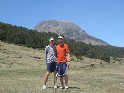
Lake Atitlan from the San Pedro Volcano

Lake Atitlan from the San Pedro Volcano

22 May 2012

Finca Tatin and Livingston

5/15-18

After a couple nights at Hotel Kangaroo, we took a “lancha” or small boat about an hour downstream, only about 20 minutes before the river dumps out in the Caribbean. Here, we stayed at “Finca Tatin” where the receptionist was a shirtless German guy named Chris. As Chris showed us the different options for a room, crabs scattered out of our way, parrots appeared in trees, and the general cacophony of the jungle filled our ears. This hotel is made up of a dozen or so thatched-roof bungalows connected by wooden dock-like walkways set deep in the jungle, only accessible by the river. Our room was on the second story of “La Casa Grande” which was simply a large thatched-roof building, entirely open with no walls. The bottom floor held 8 hammocks, and a few sofas. Our bed had a mosquito net draped over it, giving a sense of security, but also inducing sense of fear knowing that the nets were necessary. It was like camping out in the loft of a big treehouse deep in the jungle. Each night, it would rain hard, an incredibly satisfying and soothing sound as we fell asleep.


Here is La Casa Grande. We slept upstairs in the beds covered with mosquito nets.

Again, we went kayaking, this time for 4 hours up to a “biotopo” or wildlife reserve area on the river. We brought lunch with us, and as we were about to head home, it started raining harder than I’ve ever experienced. For our next two hours home, it rained furiously, requiring us to spend half of our time bailing water out of the kayak. We were drenched from head to toe after just 5 minutes. It rained so hard it almost hurt, but it was one of the more unique experiences we’ve ever had on the water. Plus, it was nice to cool down a bit in the heat. 


At the mouth of the river, a town called Livingston fuses Guatemalan life with Jamaican-like culture, into what is known as “Garifuna.” One highlight here was eating Talpado, a well-known, local soup served with a whole fish, crab, potatoes, bananas, squid, shrimp, and who knows what else in a delicious orange broth consisting mostly of coconut milk and spices. Not knowing that the dish could easily feed four people, David ordered a sandwich to complement what was assumed to be a moderate serving of soup, but when the bowl came out, we had to get an additional bowl and two additional plates just to unpack the soup. I’ve never unpacked soup before, but it was definitely necessary with this Livingston delicacy. 
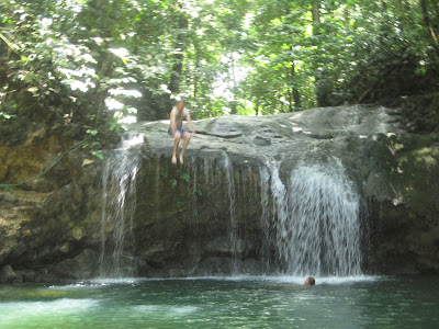
Where's David?
 Tomorrow, we take two boat trips and a 6 hour bus ride to get back to Guatemala City before flying out the next morning. We can’t believe six weeks in Guatemala is nearly over. It’s been like a long honeymoon all over again!

Caribbean Coast, as viewed from Livingston


Rio Dulce


5/13-15

Receiving a clearly Australian “Hello, mate” in the middle of Guatemala is rather strange, but that’s exactly what we got a few minutes after getting off the bus in Rio Dulce. Rio Dulce boasts the longest bridge in Central America, connecting Guatemala City and the western highlands with the Northern “El Peten” and the route to Belize. Buses cross the bridge, but everything is done by boat up and down the river.
A view of Hotel Kangaroo (from our kayak)
The U.S. Coast Guard deems Rio Dulce the safest place in the Caribbean during hurricane season, attracting many “yachties” into the safe waters for weeks, months, and even years. Gary, the Australian owner of Hotel Kangaroo, came 6 years ago, and never left. He spent two years building the hotel, which is no small feat considering the entire place is on stilts over the river. When he bought it, there was no electricity and no plumbing. The only way to come and go is by a 10-minute boat ride from Rio Dulce. Once you’re there, you sit on the dock, jump in the river, and read a good book. He’s got a few kayaks you can borrow, which we used to visit an old castle on the river. 
Castillo San Felipe
We also spent a few hours visiting “Finca Paraiso” where a hot waterfall falls 25 or 30 feet into a cool river, the only of its kind in the world. When I heard about it, I thought the water would be warm, but upon touching the waterfall, it was scalding hot. A local guide walked us upstream where the water was even hotter and showed us where to get clay to put all over our body. 

Can you spot David? hint: he's flying

18 May 2012

Tikal: The Mayan Ruins

We waited outside Tikal National Park until 3pm, at which point we walked up to the ticket booth to purchase our tickets. The guard who operates the stand waited until about 3:10, just to make sure we knew he was in charge, and then let us buy the tickets. From there, we faced a 17km walk, or wait until another car or bus came by. At 3:30, a family from France pulled up in a rental car. I went to go ask if we could jump in (there were three of us, as another tourist from Spain had the same predicament). As I got closer to the car, I saw there was a carseat with a baby and another boy in the backseat, with the parents in the front. I ruled out the possibility of joining them, but they insisted we jump in the car as there was no other traffic on the road. Louca, the 4-year old boy, sat in my lap, while the baby went up front with his mom, leaving room for Krista and our Spanish friend in the backseat. 20 or 30 minutes later, after an air conditioned ride, we finally got to Tikal.

Our hotel in Tikal was the nicest place we’ve stayed yet. Our room had a ceiling fan, we were given fresh towels, and we had our own private bathroom. Just outside our door, there was a pool to cool down from the blazing, Northern Guatemalan heat. 

The pool at the Tikal Inn was a welcome escape from the heat
We jumped in the pool, and had about an hour to enter Tikal before the park closed at 6. We walked fast, but we made it all the way to “Gran Central,” the heart of the ancient Mayan city. It was incredible. A flat, open field lies between these two Mayan Temples measuring over 40m in height.

Templo I
These temples were constructed about 1300 years ago, when Tikal was at its peak in the Mayan world. Two large complexes lie to either side of these ruins. I can’t even imagine what this place would have been like back when 150,000 Mayans were living here.

The view from Templo IV of Templo I, Templo II, and Templo III reaching above the jungle
The next morning, we met a few others at our hotel at 4am for a sunrise tour of the park. Walking for 30 minutes in the dark, our guide led us to the top of Templo IV, the furthest west Temple in the park. At 65-70m in height, this temple is by far the largest in Tikal, and as it is the furthest west, it has a view of the sun rising with the tops of the other Tikal temples poking out of the jungle top. It happened to be a foggy morning, so we did not get a great sunrise, but we got to hear and see the jungle below us come to life. Howler monkeys, the second loudest animals on earth, starting making some of the scariest noises I’ve ever heard. These are the sounds that the creators of “Jurassic Park” used for T-Rex. Birds everywhere started a symphony of different sounds. We saw a toucan perched in a tree just below us. The whole experience was unlike anything I’ve ever done. 
Here is a comparatively simple ruin inside the "Mundo Perdido" complex

Our tour included seeing more ruins, including the oldest section, named “El Mundo Perdido” or “The Lost World.” We made sure to visit each of the major 6 Temples before exiting the park to get a late breakfast. Now, we are just relaxing by the pool at the hotel until our shuttle leaves at 2:30 when we go back to Flores.

Krista peering out over Gran Central, with Templo I behind her on the right


14 May 2012

Flores


Flores is the closest thing Guatemala has to Balboa Island in Newport Beach, CA. It’s considerably smaller than Balboa Island, only taking approximately 20 minutes to walk around the island at a slow pace. With many fond memories from my childhood at Balboa, Flores was a great place to visit. The main difference is that Flores is set in a large lake with fresh water rather than a harbor with salt water. 

A view from across the lake... you can see the bridge connecting Flores to the nearby town Santa Elena

There is a walkway with a bit of a protective curb around the entirety of the island, with a couple dozen restaurants and hotels around the perimeter. Every restaurant boasted a happy hour (some of which spanned 24 hours long). Eventually, we landed on a place with Margaritas for 10 Quetzales (a little more than a dollar), where we watched the sun sink in the lake. Strangely, the temperatures after sunset don’t seem to drop a bit, which would have been a nice relief, especially in the 107 degree heat (and humid, too!). The hotel had a box fan but did not find it necessary to supply anything warmer than a top sheet. Flores is a nice stop over point on the way to Tikal, which is another 90 minute bus ride to the north, deeper into the jungle.

Sunset and Margaritas
The next morning, after Krista jogged around the island several times, we decided to jump in the lake for a swim. Every other day in Guatemala has been a day for exercise, so in between times in the lake, we did a set of push-ups on the dock and jump back in again. Afterwards, we shower off (truly no need for hot water here because the cold water, which is actually tepid, feels so refreshing) and get ready for breakfast.

On our way to find a breakfast spot at 9:30, we discover that there are no buses to Tikal after 10am, so we decided there is no time for breakfast. We check a couple of sources, and confirm that there is no bus after 10. At 9:50, I find out that the 10am bus does not run today, so I am told the only way to get there is by a private taxi. Instead, Krista and I set off for a 30 minute walk to the neighboring town of Santa Elena where they have an actual bus terminal. At 10:30, we buy two tickets for a bus that supposedly leaves at 12, despite what were told in Flores.

Sunrise from Flores
 We find a restaurant for a late breakfast and wait for an hour and a half until our guy in the bus terminal directs us to a bus. We wait another 20 minutes before taking off in the opposite direction of Tikal. However, after 5 minutes of driving, our bus parks and waits in the main market in Santa Elena for another 15 minutes. It’s sweltering hot in the back of the bus, and I’m sure I’ve lost at least a liter of water by sweating so much. It’s after 12:30, and we haven’t even left town, but once we get going again, we are going in the general direction of Tikal. I thought the bus was full, but the “ayudante” (or bus helper) finds twice as many people to fit into the bus, making it all the hotter in the bus.

By the time we get to the Tikal Park Entrance (17km from the actual ruins), we are told that we need to get out of the bus to purchase our tickets. But what we didn’t know, was that we needed to purchase tickets for two days, since we were entering before 3pm. The entrance fee at Tikal is more than 3 times that of any other park we’ve been to in Guatemala, and we literally do not have enough cash to pay for two days. We intended just to go to the hotel outside the actual ruins for the afternoon, and then explore the ruins the next day, so we only have to pay one entrance price. Instead, the guard tells us that if we are going in on this bus, we have to pay twice. We are left with only one option: waiting. So we get out of the bus and wait for an hour and half. Hopefully there will be a bus along shortly after 3, or else it’s a 17km walk up the road to our hotel. If we set out a bit after three, we shouldn’t have to walk to too far through the jungle in the dark. 

Awaiting entrance into Tikal National Park


Semuc Champey


Yesterday we journeyed from Lanquin to Flores, a 7-hour bus ride in sweltering heat and humidity. Before we start telling you about Flores, let’s take a step back and explain the awesome couple of days that we experienced between Antigua and Flores.

After spending a relaxing long weekend in Antigua, David and I “chickenbus-ed” to Guatemala City to drop our two bigger pieces of luggage off at a hotel for two weeks of storage. We then took a bus from the capital city to Coban, in hopes of journeying onward to Lanquin with the goal of reaching Semuc Champey the following day. Our bus ride to Coban took longer than expected and once we arrived in Coban (4-5 hours by bus), there were no more buses to take us the additional 2-3 hours to Lanquin.  Though at first we were a little bummed by the slight change in plans, we quickly decided to make the most of our time in Coban. We found a simple guesthouse on the same street as a gym! Gyms are few and far between in Guatemala. We paid less than $5 USD to get a great workout for both of us (and boy, were we sweaty in the intense heat with no air conditioning!) and then enjoyed a wonderful dinner by candlelight!

The next morning we woke up at 6am to head over to Lanquin. Good thing we did – because as soon as we arrived at our hotel at about 9am – there was a guided tour to Semuc Champey getting ready to depart! We dropped our bags in our room, threw on our bathing suits, and joined the departing group. We didn’t even know all the fun that we had in store for us… we jumped in the back of a pickup and rode 11km down a dirt, pothole-ridden road weaving through the gorgeous green hills. After arriving at our riverside destination, the day started with a giant rope swing into the river. Imagine a giant swing under a grand old oak tree… now transplant the swing to riverside, climb up to a platform to reach the swing high on one side of the pendulum motion, and fly down and out and up over the river below…. Splash – you’re in! Everybody in the group was pretty chicken to go, including Krista, but David jumped up and was the first to go.

After the swing, the guide handed out candles and we headed to the caves formed by an underground river. Though we don’t have any pictures to show for this unique experience, it was unlike anything we’ve ever done before. The caves go for 11km one way; pitch black if it weren’t for headlamps or candles. We only ventured in about ½ a kilometer one way, but we were in the caves for about 90 minutes… sloshing through ankle deep water, then swimming while holding our candles or headlamps above the water. David jumped off a 14-foot rock formation within the caves and we both jumped down a small waterfall carving out a narrow crevice just large enough for one person to fit through at a time.

We were happy to emerge from the dark, and enjoyed the rest of the day tubing own the river, climbing up to a lookout point hundreds of feet above the river ("El Mirador"), and swimming in the naturally formed cascading turquoise pools of water known as Semuc Champey. 
View of Semuc Champey from "El Mirador"
Our guide hopped into a tree to take this picture
Swimming in the pools
Our Cabana at El Retiro Hotel

11 May 2012

Antigua 5/9/12


Antigua, Guatemala is city that does not fit in Guatemala. It’s the outlier. It’s the city that belongs more in Europe with its cobblestone streets and impressive Parque Central. The capital of Guatemala from 1543-1774, Antigua has lots of history. And to go along with its history, it has old buildings, many of which have been lying in ruins for decades, but are being preserved. Krista and I went to one such ruins, an old school in fact, and after exploring the site, we sat on a bench in the shade for hours reading in the quiet tranquility.

Our “posada” (guest house) was called “La Casa Amarilla” (Yellow House) which was appropriately named. We stayed in a unusually large room. Large by Guatemalan standards means that my whole body fits in the bed and there is extra space to put my bag. Our room was great, with a couple of trees right outside our window. With the entire room being made of wood, it felt like a real treehouse. Included at the posada was breakfast, an incredible feast to start the day, including fresh fruit, oatmeal, pancakes, black beans, eggs, cooked tomatoes, and tea.

The rest of Antigua was great. Very relaxing, with lots of time to explore artisan markets and coffee shops. 
The increased temperature from Xela meant it was time to find the best ice cream in town, which usually followed a couple hours after chocobanana time, which became a staple afternoon snack for about $1.5 Queztales (a little more than twenty five cents $US).

Other highlights from our time in Antigua included waking up before sunrise one morning and hiking up to a lookout spot overlooking the city with the massive Volcán Agua (3766m) rising on the other side of the city. 
Watching the sun hit the Volcano first, then the city afterwards, was indescribable. Two other volcanoes, Fuego (3763m) and Acatenango (2976m), are a little more distant to the Southwest and are tougher to see.

After three nights in Antigua, we are heading to Semuc Champay (a 7 or 8 hour bus ride awaits).

30 April 2012

Volcán Santa Maria


Krista and I hiked to the top of our third Guatemalan volcano yesterday. Though not as high in elevation as Volcán Tajulmulco, Volcán Santa Maria was a much more strenuous hike. The perfectly conical volcano dominates the southern horizon from Quetzaltenango, the city where we have been living for the last three weeks. The incline is much more drastic than the other volcanoes, and it reaches over 12,500 feet. On a typical day, the top has a clear view until about 10am or 10:30am and then the clouds obscure views, but yesterday happened to be the clearest day in over a month, so we had excellent views in every direction. 50 km northwest, we could see Volcán Tajulmuco, which we had climbed last weekend. About 80 km to the southeast, we could see a cluster of volcanoes surrounding Lake Atitlan and Antigua. One of these volcanoes was San Pedro, the first volcano we hiked in Guatemala. To the south and to the east, low clouds crept in from the Pacific Ocean, and 7 km to the north, we looked down to the city of Quetzaltenango.


However, the most dramatic view was peering straight down to the southwest. A few thousand feet below the peak of Volcán Santa Maria sits Volcán Santiagito, one of the ten most active volcanoes in the world.  Approximately every 30 or 40 minutes, Santiagito erupts, releasing a big cloud of gases that forms into something that looks like a giant gray broccoli. The sound of a volcanic eruption is scary enough, but the cloud of smoke is unlike anything I’ve seen before. You can see the cloud of smoke here.


We ate lunch at the summit of Santa Maria and saw two eruptions out of Santiagito. For five or ten minutes after each eruption, Santiagito continues to grumble as it releases more vapors and gases. I am so thankful that we had such a clear day to witness one of the more unique things I will ever see. I am even more thankful that I got to enjoy this with the love of my life.


29 April 2012

Making Chocolate from Scratch


Our afternoon activity yesterday was learning how to make chocolate. No other students joined us, so we had a private lesson. Cindy, our Guatemalan activity-coordinator at the school, makes and sells 300 pounds of chocolate a week!! We made one pound of chocolate – and that was tough work!

Here’s how we did it:

1. Buy 1 lb of cacao beans (Cindy bought them at the market, ~$3 USD/lb).


2. Separate the big beans from the small ones.

3. Toast the beans until dark brown, keeping the big ones separate because they take longer to toast.


4. Separate the shell of the bean from the cacao nibs.


5. “Moler” the beans: pass through a grinder x 3 times.


6. Thoroughly mix 1 lb of sugar for every 1 lb of beans.


7. Pass mixture through grinder again.


8. Enjoy with milk (hot or cold) or just eat it “straight-up.”

chocolate con leche: frio y caliente


The chocolate we made was very pure – only cocoa nibs and sugar. We sampled it before adding the sugar: 100% cacao. It was very bitter and acidic. With the sugar it was dark and delicious.

24 April 2012

Fuentes Georginas


Krista and I took an afternoon trip to Fuentes Georginas yesterday. These hot springs were set in the most idyllic scenery: strangely tropical for such a high elevation, but with cool mountain breezes, along with a dramatic wall of vines and ferns cascading around a steep but gentle waterfall. The three man-made pools differed in temperature, where the first was fed by piping hot natural sulfur water. The second pool was a combination of an overflow of the first pool along with a less steady stream of colder water. The third was an overflow of the second. Neither Krista nor I were able to put anything more than our toes into the first pool, but the second pool was perfect for soaking, and we spent nearly an hour taking in the scenery and speaking Spanish with our two travel companions: Eduardo, the brother of the woman who runs our school, and Janet, a student at our school from Germany. 


The trip to Fuentes Georginas included taking an hour-long chicken bus to the neighboring town of Zunil, where we needed to find a driver for the 30-minute drive up the volcano to the hot springs. Most people find a pick-up truck to jump in, and ask the driver to wait for an hour or an hour and a half until you are ready to head back down the hill. Eduardo found a friend with a car to drive us, which ended up being much appreciated as the drive down the hill in the back of a pick-up truck would have been quite chilly while being so wet. 


The entire experience was extremely refreshing, especially as it came one day after our hike to the highest peak in Central America. Our bodies needed to relax, and there was no better place than in the hot springs at Fuentes Georginas.

23 April 2012

The highest point in Central America!


Volcán Tajumulco, reaching to the height of 4220 meters (~13,900 feet), is the highest point in Central America. We climbed it this past weekend! David has climbed several mountains this high or higher in the U.S., but this was the highest mountain for Krista and the highest that we’ve climbed together! 


We left Xela early Saturday morning with the adventure company Quetzaltrekkers. After traveling for a few hours on a couple of different chicken buses, we arrived in Tuhichan to begin our hike. Our group consisted of 14 people: 11 participants and 3 guides. The majority of the group was American, though Spain, Australia, Canada, and Germany were also represented. An unusually high number of the group were (or are) guides of some sort. We had a spelunking guide from Canada, a NOLS sailing and backpacking instructor working in the Caribbean and Wyoming, an Australian hiking guide, and of course David was a rafting guide. We journeyed through farmland, open meadows, and sparsely wooded forests. Some dark clouds threatened from the sky, but we were blessed with the occasional glimpse of sun and it never actually rained (or snowed!). 


In the afternoon after hiking for a few hours, we set up camp at the saddle between two peaks of the volcano. The area was sheltered from the wind with a number of pine trees and the campsite even had three toilets.


Later that evening, we hiked up to the smaller peak – Serra Concepcion – for sunset. The setting sun brilliantly illuminated the clouds in the sky. 


The night was cold and we woke up to a covering of frost on the ground. It was around 5am when we began the ascent to the highest peak of Tajumulco. We viewed the sunrise from partway up the final climb.

At the top, we enjoyed views that (on a clear day) would extend as far as Mexico (north), the Pacific Ocean (west), and more volcanoes in Guatemala (to the east and south). An enchanting thick blanket of clouds filled the valleys below the volcano, making it barely possible to see to Mexico and impossible to see the ocean. The alternating pattern of clouds and smaller mountain peaks was beautiful. The crater of the volcano was also impressive. We hiked around the entire rim.

After returning to our campsite from the sunrise ascent to the peak, we enjoyed a delicious breakfast of oatmeal, packed up camp, and headed back down the mountain. It was a gorgeous trek with wonderfully interesting people. 


Of note, the organization we chose to hike with - Quetzaltrekkers - is a neat group formed several years ago with all volunteer guides and from which all profit from the treks (they lead several in the area) are used to support a couple of nonprofits that rescue and support former “street kids” of Xela (www.quetzaltrekkers.com).